Search
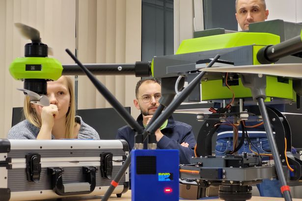
The Low-Altitude Photogrammetry and Remote Sensing Laboratory is equipped with hardware and software that can be used for educational and commercial purposes. The laboratory conducts laboratory classes related to the automation and construction of unmanned aerial vehicles, digital photogrammetry, and photogrammetry and remote sensing.
UNMANNED AERIAL VEHICLES FOR PHOTOGRAMMETRIC AND REMOTE SENSING MEASUREMENTS:
Unmanned Aerial Vehicles for Photogrammetric Measurements:
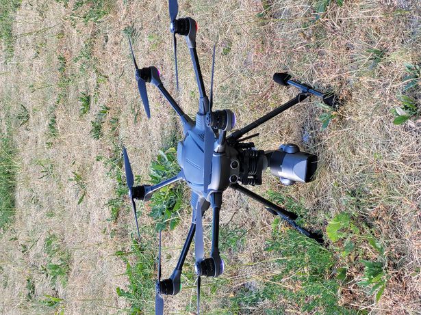
- DJI Matrice 300 RTK - a versatile platform designed for carrying measurement sensors.
- DJI Mavic Pro 2 - equipped with a Hasselblad visible light camera.
- Younec Typhoon H3 - featuring a Leica visible light camera.
Unmanned Aerial Vehicles for Specialized Purposes:
- Pelixar Light Pollution (LP) - a specialized UAV designed for light pollution measurements, equipped with a modern teledetection and sky quality measurement head. The drone is adaptable to a transport version, additionally equipped with a unique detachable device, allowing the transportation of research payloads (probes, samplers, sensors) to hard-to-reach locations for targeted measurements or sample collection.
Unmanned Aerial Vehicles for Flight Training:
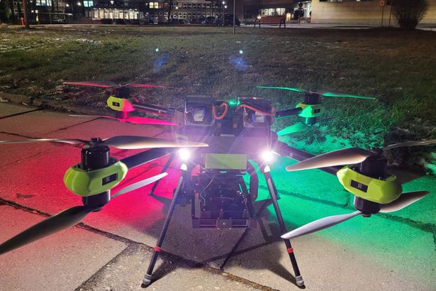
- Pelixar EDU - a multirotor UAV designed for flight training in a trainer-student system. It enables practical training in both open and special categories. With a weight of up to 5 kg, it can perform flights within line of sight as well as beyond visual line of sight.
- Pelixar LAB - a multirotor UAV, fully equipped as an open research and educational stand for tests, didactics, automation equipment testing, and UAV control.
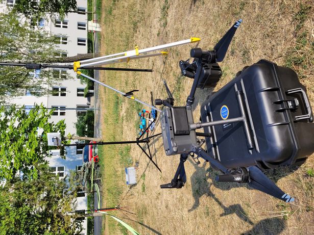
- Flight Simulator Kit - devices designed for the initial phase of flight training and the consolidation of trained pilots' habits.
Ground Photogrammetric Cameras:
- Nikon D5300 Camera with GPS - a visible light camera with a set of high-quality lenses for close-range photogrammetric measurements, including lenses:
- Nikon Nikkor 20 mm f/1.8G AF-S ED
- Nikon AF-S 35 mm f/1.8 G ED Nikkor
- Nikon Nikkor 50 mm f/1.4G AF-S
- Synchronized Photographic Cameras 2x Canon EOS 5D
- Sony A6000 Visible Light Camera with a set of lenses included in the Pelixar Light Pollution (LP) kit.
Low-Altitude Aerial Cameras for Matrice 300:
- MICASENSE MX Red and MICASENSE MX Blue Cameras - a multispectral head with 10 channels, mountable on DJI, manual mounting, and Pelixar LP UAVs.
- Micasense Altum PT with a DJI head - a multispectral camera with thermal and panchromatic ranges.
- DJI Zemnuse XT2 Thermal Imaging Camera for thermal photogrammetric measurements.
- DJI Zemnuse L1 Laser Scanner - an aerial laser scanner.
- DJI Zmnuse P1 Camera with 24 mm, 35 mm, and 50 mm lenses: high-resolution visible light camera.
- Share 102S V3 Camera - a multi-camera aerial photogrammetric head with 102 MPix, DJI mount for photogrammetric measurements.
- 2x DJI RTK Mobile Station - for precise positioning of DJI drones in flight.
3D Printers
Equipment for Design and Reverse Engineering:
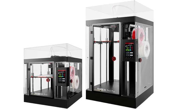
- Industrial Professional 3D Printers:
- Rise 3D Pro 3 Plus - with a workspace of 600x300x300 mm and a dual extrusion system
- 2x Rise 3D Pro 3 - with a workspace of 300x300x300 mm and a dual extrusion system
- Filament Dryers
Academic and Teaching Staff
The team of the laboratory, as well as technical staff, possess full scientific qualifications and experience to carry out low-altitude photogrammetric work.
They are educated geodetic experts and navigators with the necessary permissions for open and special category unmanned aerial vehicle (UAV) flights, including NSTS-1, 2, 5, 6, and instructor qualifications for aviation training.

Software
Modern photogrammetric software enables the creation of all currently available low-altitude photogrammetry and remote sensing products. The laboratory is equipped with all the necessary and up-to-date software currently used in the market, including:
- Pix4D Mapper
- Pix4dFields
- Bentley Context Capture
- Agisoft Metashape
- Terrascan UAV
- Matlab
- Cloud Compare
- Mission Planner
- Riscan PRO
- Geomatica
- Autodesk Fusion 360
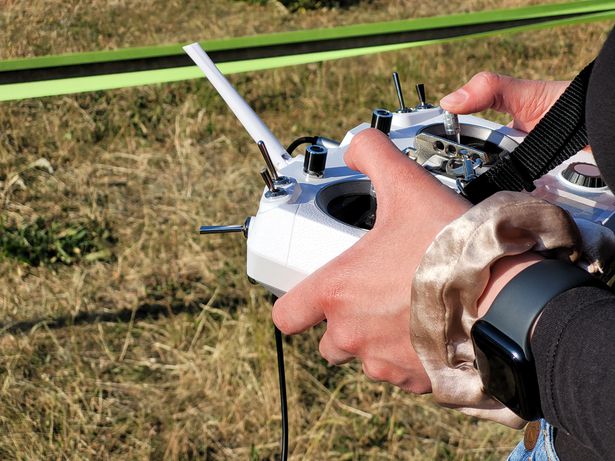
Aerial Training
Aerial training is conducted in the MR NSTS1 and 5 category (VLOS, BVLOS) as part of the curriculum in the 6th semester. Students obtain state qualifications issued by the Civil Aviation Authority.
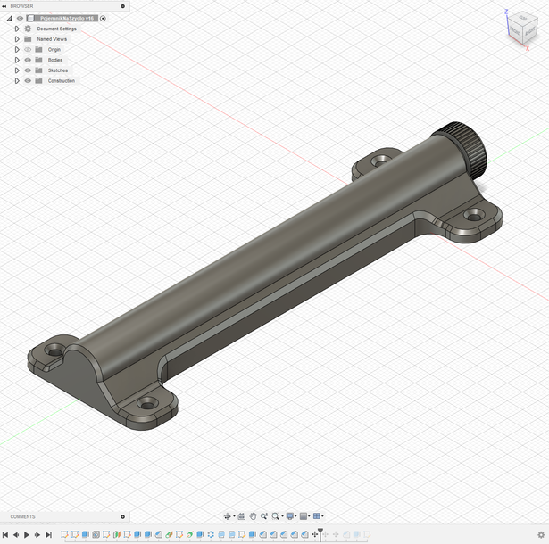
3D Design and 3D Printing
We design models and print them.
Learning 3D printing and reverse engineering from 3D scans is conducted as part of the didactic activities in the Low-Altitude Photogrammetry profile.
We print CAD models as well as models generated from photogrammetric flights.
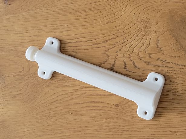
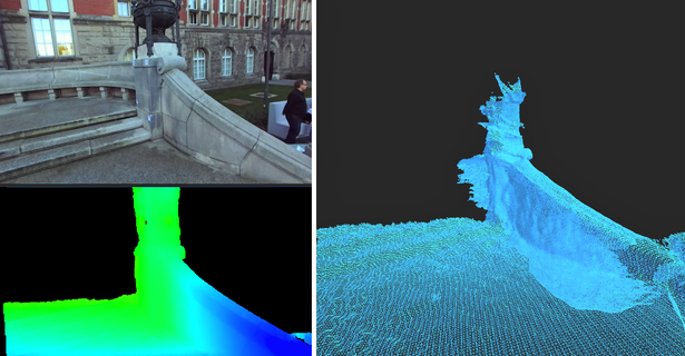
3D Models
Examples of models that we create as part of laboratory work and didactic activities.
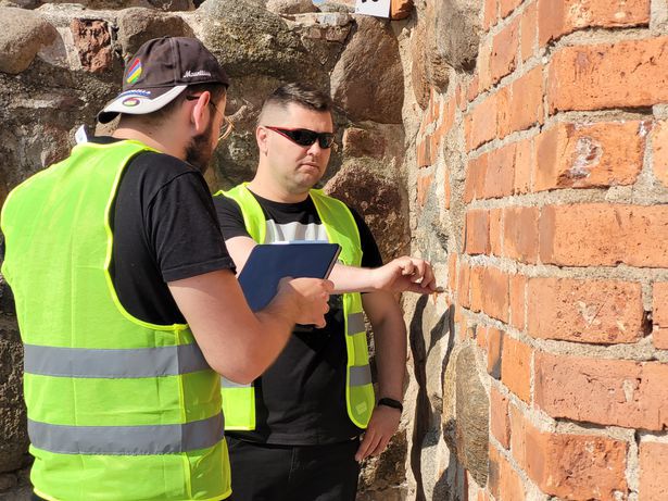
Measurement Sessions
Measurement sessions are conducted both domestically and abroad. We carry out photogrammetric measurements and geodetic processing of various kinds.
Keywords
People
Research topics / Laboratory research field
- (valid from 01-02-2022) W pracowni prowadzone są badania naukowe oraz zajęcia dydaktyczne z zakresu fotogrametrii cyfrowej i teledetekcji, szczególnie z niskiego pułapu czyli z bezzałogowych statków powietrznych. W ramach działań pracowni prowadzone są pomiary terenowe z użyciem nowoczesnych technik pomiarowych i bezzałogowych statków powietrznych, szkolenie lotnicze operatorów bezzałogowych statków powietrznych. Prace kameralne realizowane są na nowoczesnym oprogramowaniu fotogrametrycznym, dostarczanym przez wiodących producentów na rynku. Zespół pracowni tworzy również nowe oprogramowanie w tej dziedzinie.
Research Kind
-
Ocena umiejętności praktycznych i teoretycznych operatorów BSP
Przeprowadzanie egzaminu teoretycznego do wykonywania operacji w podkategorii A2 kategorii "otwartej". Przeprowadzanie egzaminu teoretycznego w zakresie zadeklarowanych krajowych scenariuszy standardowych: NSTS-01, NSTS-05 -
Pomiary fotogrametryczne
Pomiary fotogrametryczne z niskiego pułapu. Pełen zakres pomiaru wszelkich terenów. -
Pomiary teledetekcyjne
Pomiary teledetekcyjne z niskiego pułapu - pełen zakres z wykorzystaniem kamer multispektralnych. -
Szkolenie lotnicze praktyczne
Szkolenie lotnicze (praktyczne) w kategorii otwartej A1/A2/A3 oraz specjalnej NSTS-1, NSTS-5 -
Szkolenie lotnicze teoretyczne
Szkolenie lotnicze (teoretyczne) w kategorii otwartej A1/A2/A3 oraz specjalnej NSTS-1, NSTS-5
NCN discipline
- ST10 Nauki o Ziemi: geografia fizyczna, geologia, geofizyka, meteorologia, geodezja z kartografią, o / ST10_15 Geodezja, kartografia, systemy informacji geograficznej, teledetekcja
Research field & subject
- Q. Badania sensoryczne / 9. Próbki środowiskowe, powietrze, woda, gleba, odpady, osady i ścieki
- Q. Badania sensoryczne / 5. Wyroby budowlane, materiały budowlane, obiekty budowlane
Details
- Business contact:
-
Centrum Transferu Wiedzy i Technologii
- Location
- Al. Zwycięstwa 27, 80-219 Gdańsk
- Phone
- +48 58 348 62 62
- biznes@pg.edu.pl
- Contact:
-
dr inż. Paweł Burdziakowski
e-mail: pawel.burdziakowski@pg.edu.pl
- Maintainer:
- dr inż. Paweł Burdziakowski, dr inż. Katarzyna Bobkowska
- Associated units:
- Verified by:
- No verification
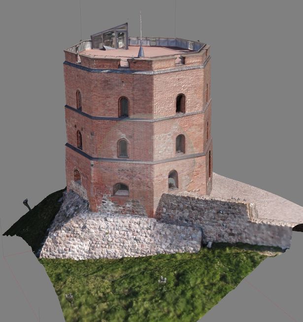
Referenced datasets
- dataset Framework for extracting rails and setting-out railway line axis based on UAV photogrammetric measurements
- dataset UAV Survey Images - 3D Model - Allegory of science figure - on the tower of the main building of Gdansk University of Technology - MP2
- dataset UAV Survey Images - 3D Model - GUT Water Tower MP1
- dataset UAV Survey Images - orthophotomap - Gdynia Container Terminal Day Light- MP1
- dataset UAV Survey Images - 3D Model - GUT Water Tower MP2
- dataset UAV Survey Images - 3D Model - Trakt Sw Wojciecha Street - Orunia
- dataset UAV Survey Images - orthophotomap - Zukowo City
- dataset UAV Survey Images - 3D Model - Wielkopolska Crossroad
- dataset UAV Survey Images - 3D Model - Zukowo Church
- dataset UAV Survey Images - 3D Model - Allegory of science figure - on the tower of the main building of Gdansk University of Technology - MP1
seen 1101 times