Search

Description
Dataset description: Raw images from photogrammetric survey.
Object: Parking place near by Gdynia Chwaszczyno district
Location: Gdynia, Pomerania, Poland
Drone type: DJI Mavic Pro 1
Flight plan: Single Grid
Target Product: Orthophoto
Date: 11.07.2019
Direct georeferencing: yes
Metadata data: yes/GPS
GCP: Yes - Description and position included
GCP Quality: GNSS RTK
Camera Name: DJI FC220
Model type: Perspective
Image dimensions: 4000x3000 pixels
Sensor size: 6.16 mm
Number of photos:170
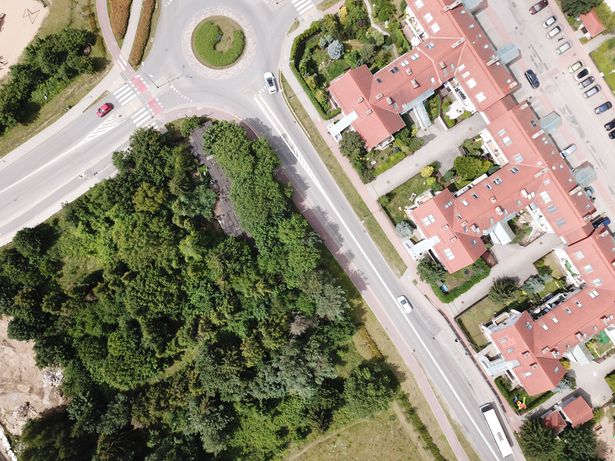
Example photo
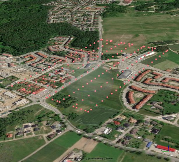
Camera positions
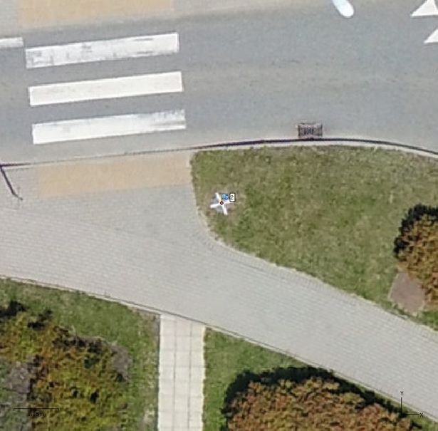
GCP no 2. marked - example
Dataset file
SI Dataset - Gdynia Chwaszczyno MP1-100.zip
804.5 MB,
S3 ETag
90b5ceae11100549189a4afa36c19932-2,
downloads: 76
The file hash is calculated from the formula
Example script for calculation:
https://github.com/antespi/s3md5
hexmd5(md5(part1)+md5(part2)+...)-{parts_count} where a single part of the file is 512 MB in size.Example script for calculation:
https://github.com/antespi/s3md5
File details
- License:
-
 open in new tab
CC BY-NCNon-commercial
open in new tab
CC BY-NCNon-commercial
Details
- Year of publication:
- 2022
- Verification date:
- 2023-01-02
- Dataset language:
- English
- DOI:
- DOI ID 10.34808/6c4x-8197 open in new tab
- Series:
- Verified by:
- Gdańsk University of Technology
Keywords
References
- laboratory Pracownia Fotogrametrii i Teledetekcji Niskiego Pułapu
- publication Increasing the Geometrical and Interpretation Quality of Unmanned Aerial Vehicle Photogrammetry Products Using Super-Resolution Algorithms
Cite as
Authors
seen 160 times