Search

Description
Dataset description: Raw images from photogrammetric survey.
Location: Żukowo, Pomorskie, Kartuski County, Poland
Drone type: DJI Mavic Pro.
Flight plan: Single grid
Target Product: Orthophotomap
Date: 22.04.2018
Direct georeferencing: yes
Metadata data: yes/GPS
GCP: yes (description and location in file)\
GCP: RTK
Camera Name: DJI FC220
Model type: Perspective
Image dimensions: 4000x3000 pixels
Sensor size: 6.16 mm
Number of photos: 448
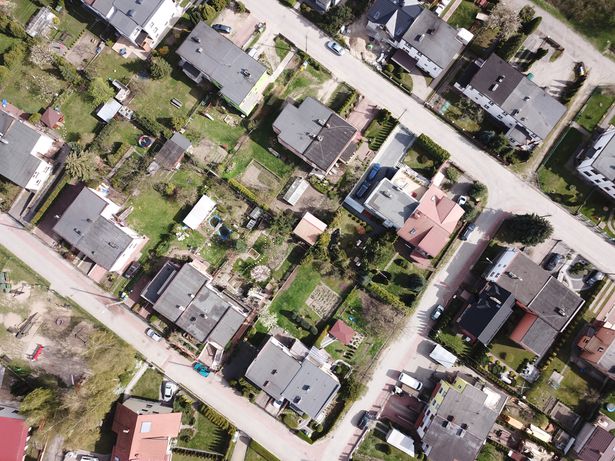
Example photo:
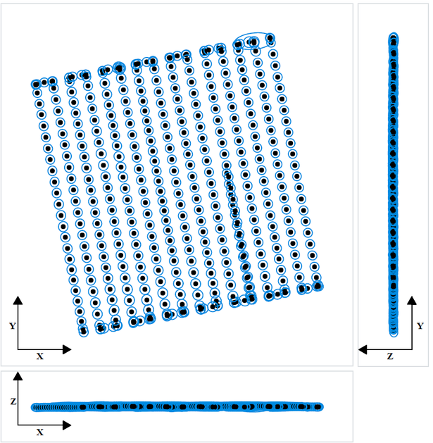
Position Uncertainties: Top view (XY plane), side view (ZY plane) and front view (XZ plane) of computed photo
positions (black dots). Blue ellipses indicate the position uncertainty, scaled for readability. The minimum and
maximum values, as well as the average value, can be found in the table below.
Dataset file
hexmd5(md5(part1)+md5(part2)+...)-{parts_count} where a single part of the file is 512 MB in size.Example script for calculation:
https://github.com/antespi/s3md5
File details
- License:
-
 open in new tab
CC BY-NCNon-commercial
open in new tab
CC BY-NCNon-commercial - Raw data:
- Data contained in dataset was not processed.
Details
- Year of publication:
- 2022
- Verification date:
- 2022-12-19
- Creation date:
- 2018
- Dataset language:
- English
- DOI:
- DOI ID 10.34808/pd8s-ms09 open in new tab
- Series:
- Verified by:
- Gdańsk University of Technology
Keywords
References
Cite as
Authors
seen 130 times