Search

Description
Dataset description: Raw images from photogrammetric and terresttial laser scaning survey.
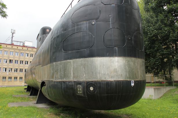
Object: Submarine Kobben - decomisioned
Location: Gdynia, Pomorskie, Poland
Drone type: n/a (Teresstrial images)
Flight plan: Free - walk arround the object
Target Product: 3D Model
Date: 05.07.2017
Direct georeferencing: no
Metadata data: No
GCP: N0 - some targets on the object are marked
Camera Name: Canon EOS 500D
Lasser type: Riegl VZ-400
Model type: Perspective
Image dimensions: 5187x3456 pixels
Sensor size: 22.3 x 14.9 mm
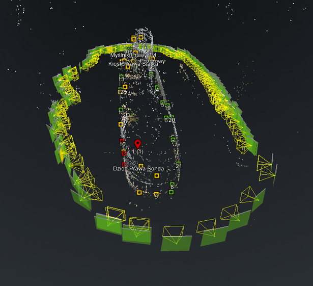
Number of photos: 361
Number of points in Point Cloud: 1 647 788
Example photo
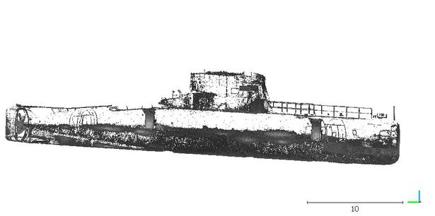
TLS
Camera position
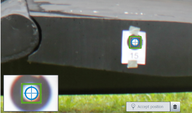
Points marked
Dataset file
SI Dataset - Submarine Kobben.zip
1.7 GB,
S3 ETag
c65c3f33adf21aac109581d6b38c3a71-4,
downloads: 75
The file hash is calculated from the formula
Example script for calculation:
https://github.com/antespi/s3md5
hexmd5(md5(part1)+md5(part2)+...)-{parts_count} where a single part of the file is 512 MB in size.Example script for calculation:
https://github.com/antespi/s3md5
File details
- License:
-
 open in new tab
CC BY-NCNon-commercial
open in new tab
CC BY-NCNon-commercial
Details
- Year of publication:
- 2022
- Verification date:
- 2023-01-02
- Creation date:
- 2017
- Dataset language:
- English
- DOI:
- DOI ID 10.34808/dp71-0966 open in new tab
- Series:
- Verified by:
- Gdańsk University of Technology
Keywords
References
- laboratory Pracownia Fotogrametrii i Teledetekcji Niskiego Pułapu
- publication Combined Close Range Photogrammetry and Terrestrial Laser Scanning for Ship Hull Modelling
Cite as
Authors
seen 213 times