Search

Description
Dataset description: Raw images from photogrammetric survey.
Object: Kościół Rzymskokatolicki Pw. Św. Wojciecha
Location: Gdansk, Pomerania, Poland
Drone type: DJI Mavic Pro 2
Flight plan: Double Grid
Target Product: Digital Terrain Model
Date: 02.04.2022
Direct georeferencing: yes
Metadata data: yes/GPS
GCP: YES
GCP Quality: RTK
Camera Name: Hasselblad L1D-20c
Model type: Perspective
Image dimensions: 5472x3078 pixels
Sensor size:1''
Number of photos: 408
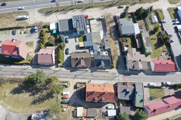
Example photo
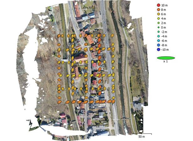
Camera Position
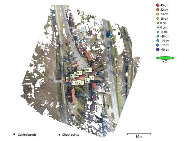
GCP Location
Dataset file
SI Dataset - Gdansk Church DTM- MP2.zip
1.1 GB,
S3 ETag
5fa087f1b4eec1bd0daaba2a1de78957-3,
downloads: 71
The file hash is calculated from the formula
Example script for calculation:
https://github.com/antespi/s3md5
hexmd5(md5(part1)+md5(part2)+...)-{parts_count} where a single part of the file is 512 MB in size.Example script for calculation:
https://github.com/antespi/s3md5
File details
- License:
-
 open in new tab
CC BY-NCNon-commercial
open in new tab
CC BY-NCNon-commercial - Raw data:
- Data contained in dataset was not processed.
Details
- Year of publication:
- 2022
- Verification date:
- 2023-01-02
- Creation date:
- 2022
- Dataset language:
- English
- DOI:
- DOI ID 10.34808/xget-qy50 open in new tab
- Series:
- Verified by:
- Gdańsk University of Technology
Keywords
References
Cite as
Authors
seen 145 times