Search

Description
Dataset description: Raw images from photogrammetric survey.
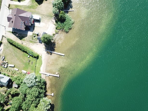
Object: Klodno Lake shore line
Location: Zawory, Kartuskie District, Pomerania, Poland
Drone type: DJI Mavic Pro 1
Flight plan: Single Grid + Obligue images
Target Product: Orthophoto
Date: 05.08.2018
Direct georeferencing: yes
Metadata data: yes/GPS
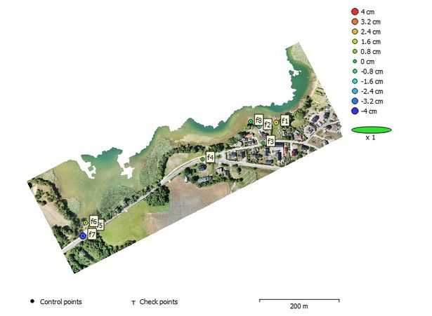
GCP: Yes - Description and position included
GCP Quality: GNSS RTK
Camera Name: DJI FC220
Model type: Perspective
Image dimensions: 4000x3000 pixels
Sensor size: 6.16 mm
Number of photos: 438 + 198
Example photo
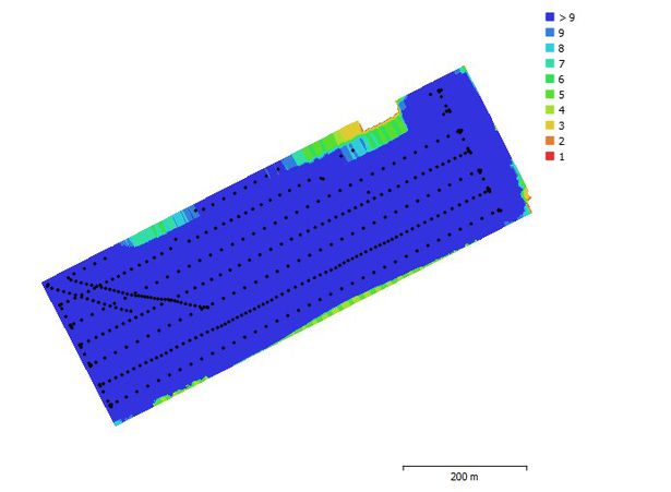
Camera position and overlap
GCP position
Dataset file
SI Dataset - Zawory Klodno Lake.zip
3.1 GB,
S3 ETag
aa267fcc0181489503fdf2e858eaabc8-7,
downloads: 75
The file hash is calculated from the formula
Example script for calculation:
https://github.com/antespi/s3md5
hexmd5(md5(part1)+md5(part2)+...)-{parts_count} where a single part of the file is 512 MB in size.Example script for calculation:
https://github.com/antespi/s3md5
File details
- License:
-
 open in new tab
CC BY-NCNon-commercial
open in new tab
CC BY-NCNon-commercial - Raw data:
- Data contained in dataset was not processed.
Details
- Year of publication:
- 2022
- Verification date:
- 2023-01-02
- Creation date:
- 2018
- Dataset language:
- English
- DOI:
- DOI ID 10.34808/a0v3-zc58 open in new tab
- Series:
- Verified by:
- Gdańsk University of Technology
Keywords
References
- laboratory Pracownia Fotogrametrii i Teledetekcji Niskiego Pułapu
- publication Shore Construction Detection by Automotive Radar for the Needs of Autonomous Surface Vehicle Navigation
Cite as
Authors
seen 166 times