Search

Description
Dataset description: Raw images from photogrammetric survey.
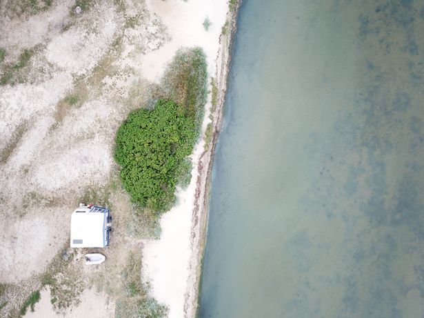
Object: Oslonino (sea) shore line
Location: Oslonino, Pomerania, Poland
Drone type: DJI Mavic Pro 1
Flight plan: Single Grid @ AGL 50m and Single Grid @AGL 100m
Target Product: Orthophoto
Date: 02.08.2018
Direct georeferencing: yes
Metadata data: yes/GPS
GCP: no
GCP Quality: N/a
Camera Name: DJI FC220
Model type: Perspective
Image dimensions: 4000x3000 pixels
Sensor size: 6.16 mm
Number of photos: 576 + 195
Example photo
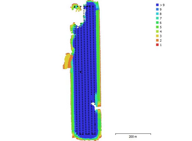
Camera position and overlap
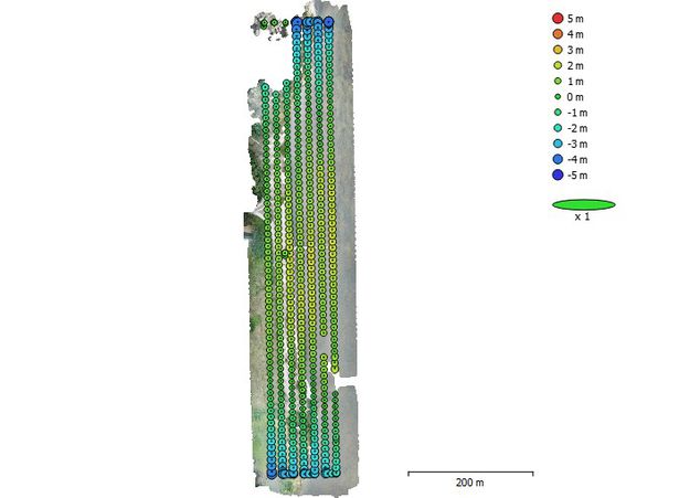
Camera position
Dataset file
SI Dataset - Oslonino Shore Line - MP1.zip
4.0 GB,
S3 ETag
b66bda498ebf7af33e75468f364d39b9-8,
downloads: 54
The file hash is calculated from the formula
Example script for calculation:
https://github.com/antespi/s3md5
hexmd5(md5(part1)+md5(part2)+...)-{parts_count} where a single part of the file is 512 MB in size.Example script for calculation:
https://github.com/antespi/s3md5
File details
- License:
-
 open in new tab
CC BY-NCNon-commercial
open in new tab
CC BY-NCNon-commercial - Raw data:
- Data contained in dataset was not processed.
Details
- Year of publication:
- 2022
- Verification date:
- 2023-01-02
- Creation date:
- 2018
- Dataset language:
- English
- DOI:
- DOI ID 10.34808/6vk4-dq67 open in new tab
- Series:
- Verified by:
- Gdańsk University of Technology
Keywords
References
Cite as
Authors
seen 122 times