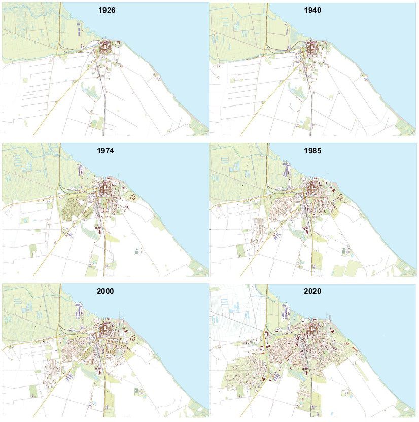
Analysis of spatial changes in the town of Puck with its surroundings in the years 1926, 1940, 1974, 1985, 2000, 2020 on the basis of topographic maps using the BDOT10K database

Opis
Spatial changes over time are extremely valuable due to the possibility of modeling forecasts. This dataset shows how Puck has evolved over a specific period of time. Thanks to this presentation of the data set, it is possible to easily recreate the appearance of the city in particular years.
The spatial changes in Puck with its surroundings in the years 1926, 1940, 1974, 1985, 2000, 2020 using archival scans of topographic maps issued in 1926, 1940, 1982, 1988, 2000 and the BDOT10K data set. To analyse and present the results of work in descriptive and graphic form, the following programs were used: QGIS 3.14.16-Pi, ArcGIS Pro 2.6.0. The analysis of objects without source information was based on the principle of similarities and repeatability. The obtained results should be treated with an error accuracy of approximately 1 mm in the base map scale.

Plik z danymi badawczymi
hexmd5(md5(part1)+md5(part2)+...)-{parts_count} gdzie pojedyncza część pliku jest wielkości 512 MBPrzykładowy skrypt do wyliczenia:
https://github.com/antespi/s3md5
Informacje szczegółowe o pliku
- Licencja:
-
otwiera się w nowej karcie
CC BYUznanie autorstwa - Oprogramowanie:
- QGIS
Informacje szczegółowe
- Rok publikacji:
- 2020
- Data zatwierdzenia:
- 2021-03-01
- Data wytworzenia:
- 2020
- Język danych badawczych:
- polski
- Dyscypliny:
-
- architektura i urbanistyka (Dziedzina nauk inżynieryjno-technicznych)
- DOI:
- Identyfikator DOI 10.34808/4bvb-4f44 otwiera się w nowej karcie
- Weryfikacja:
- Politechnika Gdańska
Słowa kluczowe
Cytuj jako
Autorzy
wyświetlono 235 razy
