Search

Description
Dataset description: Raw images from photogrammetric survey.
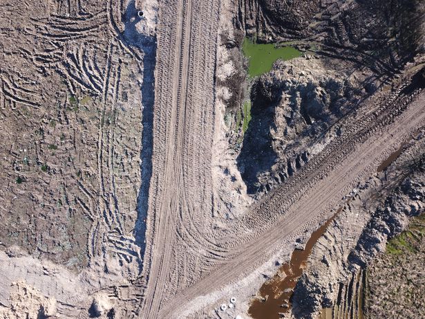
Object: A garbage dump near by Wladyslawowo city
Location: Wladyslawowo, Pomerania, Poland
Drone type: DJI Mavic Pro 1
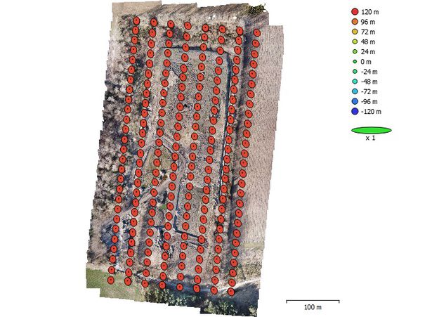
Flight plan: Single Grid
Target Product: DEM
Date: 14.03.2020
Direct georeferencing: yes
Metadata data: yes/GPS
GCP: Yes - Description and position included
GCP Quality: GNSS RTK
Camera Name: DJI FC220
Model type: Perspective
Image dimensions: 4000x3000 pixels
Sensor size: 6.16 mm
Number of photos: 224
Example photo
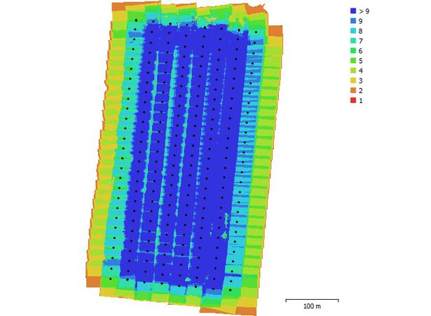
Camera position and overlap
Camera location
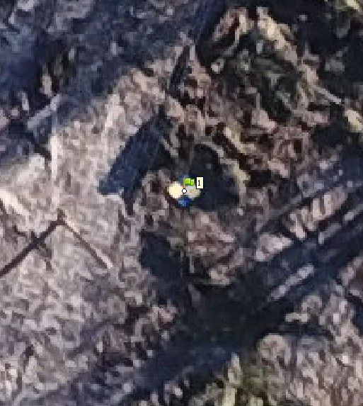
GCP - signalised
Dataset file
SI Dataset - Garbage Dump - MP1.zip
1.1 GB,
S3 ETag
8bbf93ca8c2e4098a4643036a9b22141-3,
downloads: 79
The file hash is calculated from the formula
Example script for calculation:
https://github.com/antespi/s3md5
hexmd5(md5(part1)+md5(part2)+...)-{parts_count} where a single part of the file is 512 MB in size.Example script for calculation:
https://github.com/antespi/s3md5
File details
- License:
-
 open in new tab
CC BY-NCNon-commercial
open in new tab
CC BY-NCNon-commercial
Details
- Year of publication:
- 2022
- Verification date:
- 2023-01-02
- Creation date:
- 2020
- Dataset language:
- English
- DOI:
- DOI ID 10.34808/qgg1-g084 open in new tab
- Series:
- Verified by:
- Gdańsk University of Technology
Keywords
References
- laboratory Pracownia Fotogrametrii i Teledetekcji Niskiego Pułapu
- publication A Novel Method for the Deblurring of Photogrammetric Images Using Conditional Generative Adversarial Networks
Cite as
Authors
seen 169 times