Opis
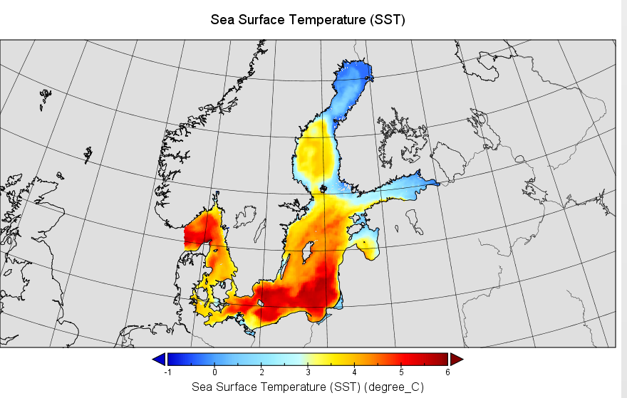
Monthly mean sea surface temperature (SST) from 2001 to 2022 calculated from data from the SatBaltic System (https://satbaltyk.iopan.gda.pl/). The spatial resolution of the maps is 1 km. The calculation of monthly mean values at each pixel was based on four SST maps on each day of the month. The primary source of SST information was satellite data collected by the Advanced Very High Resolution Radiometer (AVHRR) and Moderate Resolution Imaging Spectroradiometer (MODIS). Gaps in the satellite images due to the presence of clouds were filled using the PM3D numerical hydrodynamic model.

Average surface temperature of the Baltic Sea in January 2001
Plik z danymi badawczymi
x_ss_sst_merge-sb1k_avg_month.nc
121.0 MB,
S3 ETag
59db727961ec6d0efb0673b66b6948f3-1,
pobrań: 65
Hash pliku liczony jest ze wzoru
Przykładowy skrypt do wyliczenia:
https://github.com/antespi/s3md5
hexmd5(md5(part1)+md5(part2)+...)-{parts_count} gdzie pojedyncza część pliku jest wielkości 512 MBPrzykładowy skrypt do wyliczenia:
https://github.com/antespi/s3md5
Informacje szczegółowe o pliku
- Licencja:
-
otwiera się w nowej karcie
CC BY-NC-SAUżycie niekomercyjne - Na tych samych warunkach - Oprogramowanie:
- Software for Manipulating or Displaying NetCDF Data
Informacje szczegółowe
- Rok publikacji:
- 2024
- Data zatwierdzenia:
- 2024-04-26
- Język danych badawczych:
- angielski
- DOI:
- Identyfikator DOI 10.34808/weey-7864 otwiera się w nowej karcie
- Seria:
- Weryfikacja:
- Politechnika Gdańska
Słowa kluczowe
Powiązane zasoby
- publikacja The operational method of filling information gaps in satellite imagery using numerical models
- publikacja Combining Satellite Imagery and Numerical Modelling to Study the Occurrence of Warm Upwellings in the Southern Baltic Sea in Winter
- dane badawcze Monthly mean concentration of chlorophyll a on the sea surface of the Baltic Sea
Cytuj jako
Autorzy
wyświetlono 208 razy

