Wyszukiwarka

Opis
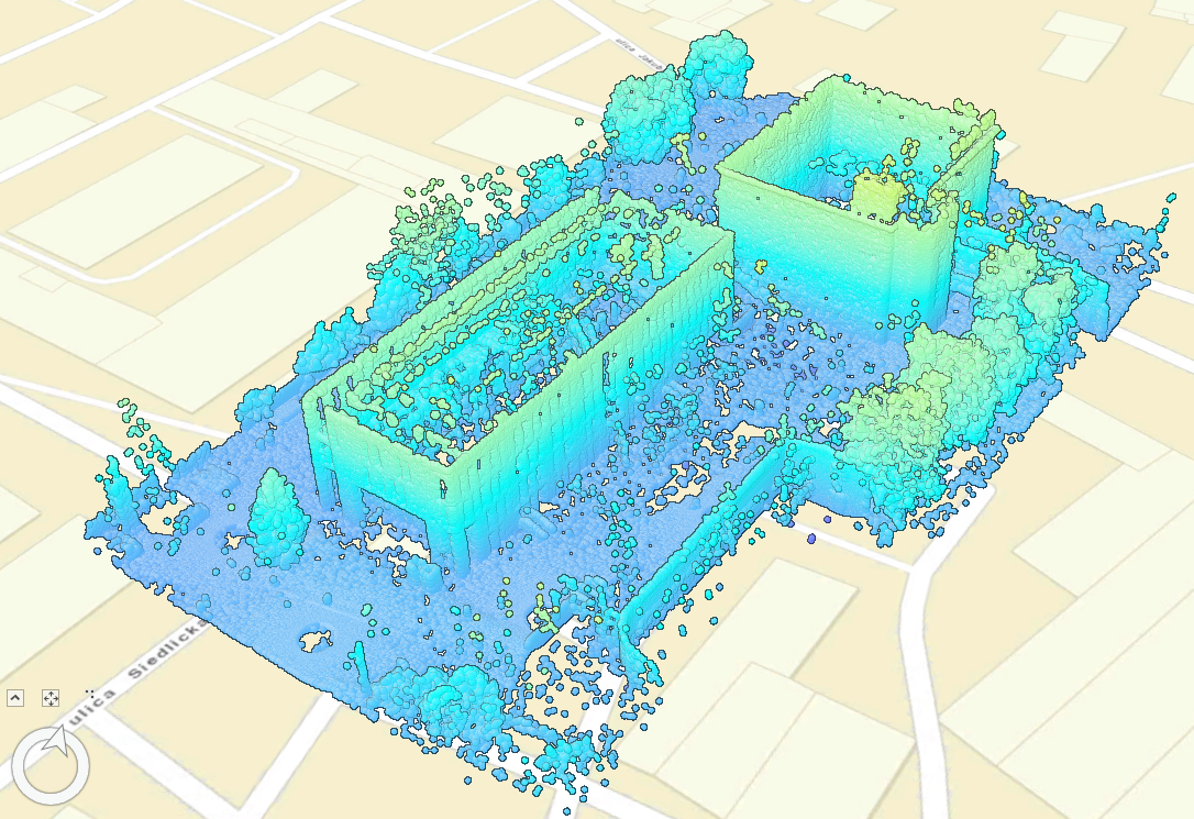
The product presents the point cloud in the collection of a three-dimensional database in spatial order as the representations of the Nanotechnology Center and the Auditorium Novum buildings (located on the campus of the Gdańsk University of Technology) acquired in the laser scanning technology. According to its high accuracy and precision of data acquisition (about 1 mm at a distance of 10 m), this method finds its application in many areas of human life (i.e. medicine, architecture, agriculture or civil engineering). For data acquisition the Riegl VZ-400 instrument was used and the data alignment was performed using least-squares method. The next step was bound to transform the dataset to the PL-ETRF2000 system zone 6 horizontal coordinates and PL-KRON86-NH for heights. To sum up the available on the website file presents a set of points in the .txt format showing horizontal and height coordinates as well as the intensity of the light beam reflection from the measured object.
The purpose of the measurement was to update the spatial database. The update concerned an urban change in the form of the construction of the Nanotechnology Center building. The data can be used for the needs of inventory (e.g. in the form of spatial maps in two and three dimensions) and spatial analysis regarding e.g. wall deviations from the surface, determining the building volume.
Plik z danymi badawczymi
hexmd5(md5(part1)+md5(part2)+...)-{parts_count} gdzie pojedyncza część pliku jest wielkości 512 MBPrzykładowy skrypt do wyliczenia:
https://github.com/antespi/s3md5
Informacje szczegółowe o pliku
- Licencja:
-
 otwiera się w nowej karcie
CC BYUznanie autorstwa
otwiera się w nowej karcie
CC BYUznanie autorstwa - Oprogramowanie:
- ArcGIS, CloudCompare, Leica Cyclone 3D, LIMON, DEPHOS SOFTWARE,
Informacje szczegółowe
- Rok publikacji:
- 2019
- Data zatwierdzenia:
- 2020-12-17
- Data wytworzenia:
- 2020
- Język danych badawczych:
- angielski
- Dyscypliny:
-
- architektura i urbanistyka (Dziedzina nauk inżynieryjno-technicznych)
- DOI:
- Identyfikator DOI 10.34808/rfxw-j124 otwiera się w nowej karcie
- Weryfikacja:
- Politechnika Gdańska
Słowa kluczowe
Cytuj jako
Autorzy
wyświetlono 645 razy